Showing posts with label Chaco Cultural National Historical Park. Show all posts

Saturday, June 27, 2009

May 24 - South Mesa Trail (Chaco pt 4)

Today we viewed Chetro Ketl, Hungo Pavi, some petroglyphs between Pueblo Bonito and Chetro Ketl, and took a 4 mile loop hike to Tsin Kletzin. Great weather today and two worn out pups that slept all night.

Below are the pics from our second full day at Chaco Canyon.


Petroglyphs between Pueblo Bonito & Chetro Ketl
Indentions in the cliff face - believed to be where
tools were sharpened, but no one really knows.
Rock like the one that fell on Pueblo Bonito


Look carefully & you can see where there
was once a balcony along this Chetro Ketl wall

Window looking into a room at Chetro Ketl

The South Mesa Trail is mostly flat, once you get on top of the mesa. It's a bit of a scramble to get up to the top - either direction, from the south gap or from the trailhead at Casa Rinconada. We started at Casa Rinconada and did the entire loop which is 4.1 miles round trip. If you just go to Tsin kletzin and back (from CR) its about 3 miles rt. However, I highly recommend the whole loop - yeah, some of the scenery get's boring but the trail coming off the mesa near South Gap is just amazing!!! Quite a climb down but so worth it.

Tsin Kletzin was built and occupied near the end of the Chacoan "empire", between AD 1100-1125.

"Fat Dog Canyon" along the South Mesa Trail
Not so good for fat people either - we squeezed
through just barely. haha
View toward Pueblo Bonito and Pueblo del Arroyo
from South Mesa Trail
Tsin Kletzin ruins about a 1.5 miles in on the
South Mesa Trail
Approaching Tsin Kletzin
South Mesa Trail
View from South Mesa Trail
South Mesa Trail
Hannah & Maggie resting in about the only
shade on the trail
Another view from SMT
Where the South Mesa Trail ends - Casa Rinconada Kiva


The stairs are on the right-hand side
of this picture.
Rainbow back at camp
Pooped pups.

Tuesday, June 23, 2009

May 23 - Pueblo Alto & others (Chaco pt 3)

Thunderhead over the mesa
After visiting Pueblo Bonito we thought we'd head up the Pueblo Alto trail to see the Bonito overlook and maybe make it on over to Pueblo Alto. It was starting to rain by that point and the first 300 ft or so of the PAT is a hard scrambled up & over boulders and toe-holds once used by the Chacoans. The puppies, Hannah & Maggie, of course, raced up the trail until they hit their first boulder - then they were ready to head back down. After boosting them up and dragging them around wet, slick rocks we decide to bag PAT for the time being and go on another hike that wasn't so strenuous - the Penasco Blanco Trail fit bill. Longer than we wanted to go, but long enough to wear H & M out so they would wait patiently in the Jeep while we did the Pueblo Alto trail.
Bryan, Hannah & Maggie on
the Pueblo Alto Trail
Looking down part of the PA trail
The Penasco Blanco trail is relatively flat and includes Casa Chiquita, Kin Kletso, petroglyphs, pictographs and Penasco Blanco. To PB and back is 7.4 miles, petroglyphs were 3.4 miles RT - we made it to Casa Chiquita before heading back. It rained on us a good bit, but that kept it cool. Can't imagine this area in the summertime.

Bryan, H & M on the Penasco Blanco Trail
Views from the Penasco Blanco Trail

Casa Chiquita ruins

We successfully pooped out the dogs, stowed them in the Jeep and tried the Pueblo Alto Trail again. The entire loop of PAT is 5.4 miles long. By this time we were starting to poop-out too so we opted for the shorter trip out to the Pueblo Bonito overlook which was just a two mile round trip and once you made it to the top of the mesa - a very easy walk. We want to go again and make it to Pueblo Alto (3.2 mi RT) as this part of the trail passes by old Chacoan ramps, stairways, roads, etc.

As it is, the Pueblo Alto trail starts off near Kin Kletso ruin and uses the same, uhm "trail" that the Chacoan's used to gain access to the mesa top. What a climb! Elevation gain was 250 feet and it seemed you gained that elevation in about 250 feet. Very cool though, as once you scramble over the boulders you squeeze through a long rock crevice and emerge on top. A great trail if you are up to the initial climb up (& of course, back down, which is much scarier).

Sign explaining Kin Kletso
Kin Kletso from the Pueblo Alto Trail
Bryan looking up the crevice we have to
climb through on the Pueblo Alto Trail
Bryan near the top
Raymona dragging her rear, I mean
dragging up the rear.
This is where you emerge on top
of the mesa. Amazing, huh?
Trail on top of the mesa
Small rock cairn marking the trail
Hand-pecked basins along the trail
Believed to be used ceremonially
View from Pueblo Alto trail across
Chaco Canyon
Pueblo del Arroyo from mesa top
View of Pueblo Bonito from the overlook

Sunday, June 14, 2009

May 22 - Arriving at Chaco Cultural National Historical Park

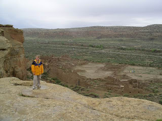
We arrived at Chaco Canyon just a few minutes after 5 PM on Friday evening, May 22. Since the Gallo Campground does not accept reservations and is fairly small, about 40 sites or so) we called just before we left Beranlillo to make sure that there were sites available - there were so we headed out. It took about 3.5 hours to get to Chaco from Bernalillo (about a third of the time was spent on the 21 miles of rough dirt road) and in that time the campground filled up. The park hosts were gracious enough to let us 'camp' in the closed group campsite overnight since several people were leaving the next morning. We got a primo-site, #20 the next morning and thus began our visit.
Gallo campground is really nice, surrounded by rocky cliffs, there are some petroglyphs (vandalized by idiots of course) and some smaller cliff dwellings you can exploe just steps from you campsite. Not a lot of privacy or trees (so could be blistery in the summer) but nice overall. No hook-ups, no potable water in the camp (you have to go about 2 miles to the visitor's center for water) but they do have flush toilets and running water in the bathrooms - no showers).
Part of the Gallo Campground
from the Overlook Trail
Our campsite #20
The weather wasn't the best on our trip - rain and thunderstorms but at least it stayed cooler. I bet this place bakes in the summer time. So in between rain showers we explored most of what Chaco has to offer. There were a couple trails and thus pueblos that we missed but we'll hit them sometime soon. One nice thing about Chaco Culture Historical Park is that you can take your dogs on the back-country trails as long as they stay leashed, and do not enter any of the ruins. I'm sure that people will abuse it and ruin it for us responsible pet owners but for now its great to be able to hike with your dogs - especially when they are hyper puppies that need to be worn out.
First stop was the visitor's center for a few trail guides and an introduction to Chaco. On Tuesdays, Fridays & Saturday's the visitor's center hosts 'star-talks' and star-gazing with their telescopes, unfortunately for us, the weather most certainly did not cooperate in the star-gazing department but we did sit through three great talks - Friday, the historic trading posts of the San Juan Basin, Saturday, the night sky at Chaco & some astronomical signs in & around the park, and Sunday was a excellent talk by one of the campground hosts who is also a Mayan Archeologists about the chocolate found in Chaco.

One of the great mysteries of Chaco is that no one really knows what it was used for. Most agree that no one lived her permanently since they haven't found the huge midden heaps or graves, etc that would indicate a large population lived here year-round. Some theories indicate that Chaco Canyon was a place for celebration and ceremonies, others a trading center or a combination of the two. The buildings in Chaco were built over a 300 year span (A.D 850 - A.D. 1150) in planned statges. Then suddenly, and with no record of why or where they abondoned these magnificent buildings.

There is evidence that there was trade with the people of Central Mexico. Whether it was direct trade (Chacoans traveling to Mexico or vice versa) or indirect, where the goods were handed up from Central Mexico we may never know but archeologists have found the skeletal remains of macaws in the some of the buildings in Chaco, shells, copper bells and more recently (Feb 2009) "chocolate" was discovered in some Chacoan pot sherds of cylindrical vases dating between A.D. 1000-1125 - some 400 years earlier than when scholars first thought chocolate came to North America!!! At the time, the only people who had chocolate were the Aztecs, about 1200 miles south!! (Click on this link to read more about it: http://news.nationalgeographic.com/news/2009/02/090202-ancient-chocolate.html )
In reciprocation, turquiose and other southwest influences have been found in some ruins of central Mexico.

Over 400 miles of pre-historic roads criss-cross the San Juan Basin, linking Chaco Canyon to its outlying neighbors. These roads were planned and engineered - most 30 ft wide, and straight, if they encountered a cliff face, the Chacoans carved steps and hand-holds into the face and continued the road on top of the mesa.

Chaco Canyon National Monument was established on March 11, 1907. On December 19, 1980, CCHM was re-designated Chaco Cultural National Historical Park and in 1987 received international recognition through the designation as a World Heritage Site.

If you get a chance to go - please do. It is a fantastic place to visit and let your imagination roam. It's a fascinating, mysterious place. And please respect that this is also a sacred site to many Native Americans.

More photos to come, I just wanted to give you a quick background on Chaco first...

May 23 - CCNHP - Pueblo Bonito (Chaco pt 2)

REMEMBER TO CLICK ON ANY IMAGE FOR A LARGER VIEW

Saturday morning found us looking at gray dreary skies and cool weather, but no matter. With the threat of rain looming (literall) over our heads we hit the trails and the Pueblos. After a quick stop at the visitor center for trail maps and guides we were on our way.

We went directly to Pueblo Bonito, one of the more famous of the Chaco Great Houses. The trail through Bonito is 0.6 miles and graveled with some short steps and low (really low) doorways. It is wheelchair accessible to stop 2 and then backtrack to stop 19.

Pueblo Bonito was undercontruction off & on from AD 850 to about AD 1125. The great houses were oriented to the solar, lunar & cardinal directions and Bonito was no exception. The great houses of Chaco Canyon were surrounded by sophisticated astronomical markers, communication features, water control devices, and engineered roads. Pueblo Bonito was named by Lt James Simpson and his Mexican guide, Carravahal in 1849. It had been "excavated" many times before the official excavations begun in the 1920's.


Bryan in front of Pueblo Bonito
Pueblo Bonito
In 1941, a detached segment of the cliff wall named Threatening Rock, fell and destroyed about 30 rooms of Pueblo Bonito. Threatening Rock was seperated from the cliff by a wide crack - the rock measured 97 feet high, 140 ft long & 34 ft thick and weighed an estimated 30,000 tons!! The Chacoans that built here were aware of the threat the rocks possessed. They places prayer sticks (pahos) in the crevice between the rocks & the cliff face. They also built masonry terraces below the base to help counteract soil erosion. The traditional Navajo name for Bonito is Tsé-biyah-nii'a'ah, which means "rock that braces & supports the structure from below". The next couple of photos show the fallen rock in and around PB.

Parts of Theartening Rock with
Bonito in the background

Bonito from Threatening Rock

The walls of PB are constructed in the core-and-veneer fashion. The core is filled with irregular bits of sandstone laid in a mud mortar it was then faced on both sides with carefully selected selected and shaped stones to create the veneer. The Chacoans applied a plaster coating over most walss, this helped to protect the mud mortar from rain and decreased the maintenance.

Pueblo Bonito, like other multi-storied great houses, has really wide first floor walls. This created strong, stable base upon which to build additional stories; each subsequent floors' walls were thinner, lightening the load of the upper stories. PB had 3-4 stories in the back and tapered down to single stories in the front, along the central plaza.

Part of the back wall of Chaco - about two stories tall


Raymona - Pueblo Alto trail (a whole other blog post)
looking down on Pueblo Bonito
The central plaza of Pueblo Bonito contain several kivas. Kivas are a key element of Chacoan architecture and are found in almost every Chacoan community between AD 900 & AD1200. The design, size and central position of great kivas suggest a ceremonial purpose and indeed modern puebloans use kivas for religious worship.

View of the Pueblo Bonito central plaza

One of the kivas in Pueblo Bonito

Looking from the inside of Pueblo Bonito
toward the cliff wall

I love this photo - looking east out of a
Pueblo Bonito window toward Chetro Ketl
The inner doors in PB, and most of the other Pueblos are SMALL or maybe I should say small.
You "walk" through 11 narrow doors (20-27" wide and 41-46" tall) on your tour of the Pueblo. In the photo below you can see how small they are (not how big I am - hee hee) - holes you see above the door were used to hold vigas - log beams that supported the ceiling and floors above.

Raymona next to a typical
Chacoan doorway
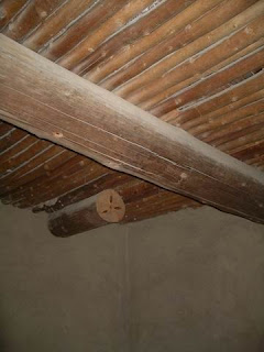
Researchers say that over 225,000 trees were cut and used in the construction of the Pueblos in the Chacoan communities. These trees came from mountain forests dozens of miles away. The lumber was cut, allowed to dry for a year and then hand carried back to Chaco for construction.

This sign describes the best preserved room
in Pueblo Bonito
Bryan in the room that was the best preserved
in Bonito. The plaster found here was original but
has since been replastered to protect it. This is
how it would have looked (without the flash)
when the original people built it.

Original vigas (roof beams) and
latillas (slats) in a room at Pueblo Bonito